Snow remote sensing
Estimating snow cover using satellites
Why are we interested in detecting snow? Snow is a pretty integral component of the global climate system. First, fresh snow is really bright (a property we would call high albedo). That high albedo reflects a lot of the radiation from the sun, which can regulate the land temperature. Snow melt is also a dominant source of water in many regions across the planet.
My interest in snow is its influence on permafrost soils. It might seem counterintuitive, but snow actually insulates the ground during winter and keeps the ground warmer than the cold air temperature. The insulating effect can cause soils to not refreeze during the winter, which can cause degradation or thawing of permafrost. We want to know where snow is the thickest or hangs out the longest on the landscape, especially in tundra ecosystems, so we can investigate the impact of snow on permafrost freezing/thawing.
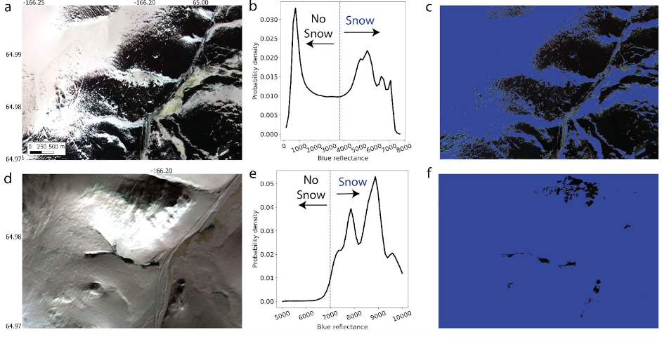
It turns out that snow is has high reflectance (is really bright) in the blue wavelengths. We developed an algorithm called the Blue Snow Threshold algorithm, which dynamically sets a threshold blue reflectance value to separate snow and non-snow pixels (Figure 1). Now, because we are only using blue wavelengths, we can use high-resolution satellites to actually map the distribution of snow on the landscape throughout the year.
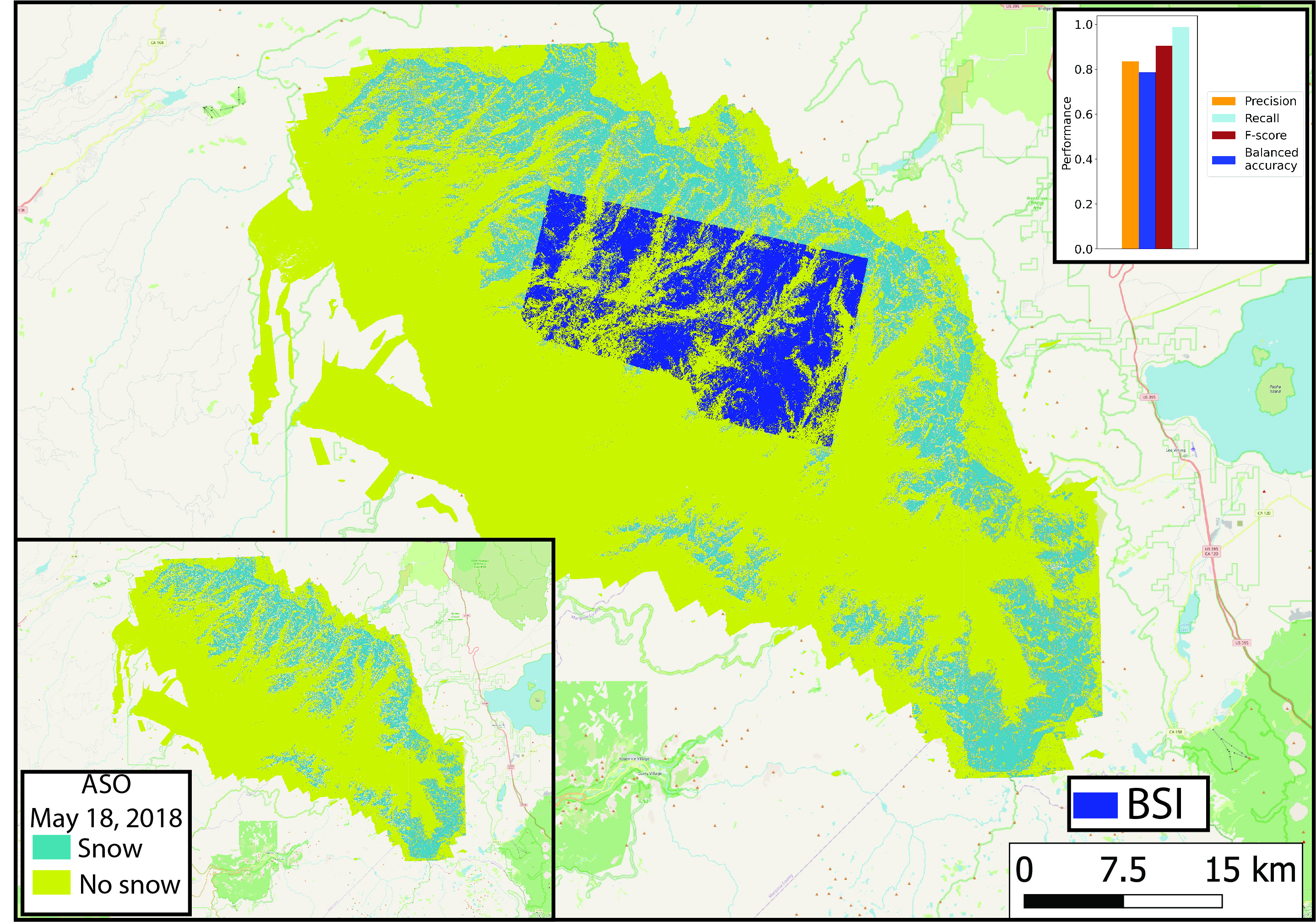
Validating our snow cover estimates
We compared the extent of snow covered area predicted by just using the blue wavelength to snow cover estimates from Landat 8, which uses many different wavelengths and to snow covered area measured with repeat lidar scans (Figure 2). Lidar is a fancy laser range finder attached to an airplane or helicopter. We found that just using the blue wavelengths works really well and is really easy to do! You can read more about our method in the paper published in Remote Sensing of Environment (Thaler et al., 2023).